Strategic Assets
Regionally Optimised Marine Assets
We Have Grown Globally
Java Offshore operates various multi-purpose survey vessels equipped with state-of-the-art equipment.
We have grown globally to acquire, process, interpret and present geophysical/ hydrographic data to illustrate seabed and sub-seabed hazards critical for the offshore industry. Our vessels operate to International classification standards to serve the region efficiently and align with our aims to provide you with the most innovative, productive and advanced solutions whilst maintaining the highest safety standards as expected in the Industry.
Our Survey Vessels
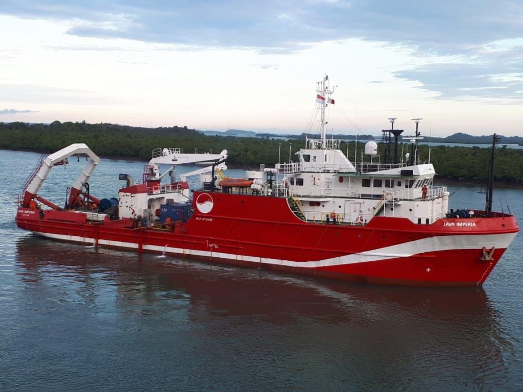
MV Java Imperia
The Caterpillar diesel electric drive, Kongsberg Dynamic Positioning capability and 25 Tonne A-Frame makes her a suitable platform to conduct numerous operations from Geophysical Surveys, ROV Inspections to Coring in deeper waters.
MV Java Imperia has proven to be a reliable and sound platform for Survey Operations. Since 2012, she has successfully completed various survey campaigns from Bathymetry Operations in deep water using the Autonomous Underwater Vehicle to countless single pass Analogue and 2D High Resolution Seismic Surveys for multiple clients in the region.
Pre-installed survey and navigation equipment operated from a dedicated and spacious survey room allows for rapid mobilization in a comfortable working environment offshore.
The Survey equipment on-board includes a full suite of Analogue and Digital Spread, Gravity Coring spread and a mid-range Autonomous Underwater Vehicle (AUV).
She is suited for various operations:
- Geophysical Site Survey
- 2D Hi-Res Seismic Survey
- Pipeline / Cable Route Survey
- Environmental Survey
- Debris Clearance Survey
- ROV Inspection
- Coring Services
- Seabed CPT Operation
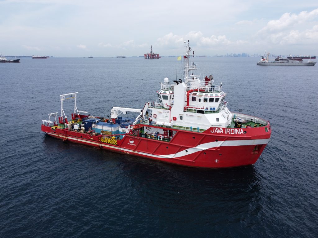
RV Java Irdina
RV Java Irdina is a 50-meter vessel, setup as our dedicated Geophysical vessel. She was designed for seismic operations, which makes her a suitable platform to conduct multi-survey operations for 2D/3D campaigns in a single pass. This include Analogue and 2D Hi-Resolution Data Acquisition campaigns.
RV Java Irdina is equipped with full set survey equipment of analogue, digital spread, gravity coring spread and a mid-range Autonomous Underwater Vehicle.
Apart from her operational capabilities, RV Java Irdina has spacious accommodation for 40 personnel and
installed with specially designed lifting systems to conduct both analogue/digital operations as well as soil
sampling operations. The 3t and 10t A-frame are located at starboard and port quarter respectively
She is suited for various operations:
- Geophysical Site Survey
- 2D / Hi-Resolution Survey
- Geotechnical Survey
- Multi role Survey Operations
- Seismic Supply and Support
- Standby / Guard
Dedicated Geotechnical Vessels Ready For Offshore Investigations
Our dedicated geotechnical vessels are specifically designed and equipped with state-of-the-art equipment to drill for answers and boost overall productivity.
Our vessels can also be fitted with other survey equipment to accommodate your unique needs. They are fitted with 4-point mooring systems holding capability and maintain on-board soil testing laboratories, they can perform drilling including CPT, sampling and pilot holes in water depths up to 650m.
Our Geotechnical Vessels
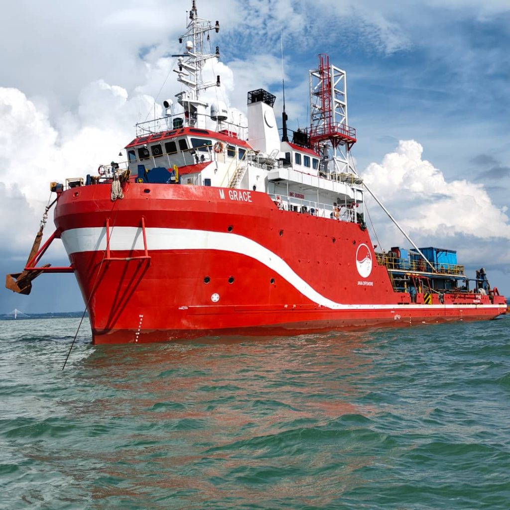
MV M Grace
M Grace is setup as a Dedicated Geotechnical Vessel which equipped with a self deployed 4-point mooring system.
She is a proven multi-purpose vessel offering a range of drilling, in situ testing and sampling services operated
through a central moon-pool at the midship of vessel, enabling stability and verticality during drilling and testing operations.
The geotechnical system onboard is capable to perform soil boring operations in support of jack-up , hydraulic push sampling, downhole cone penetration (CPT) and in-situ vane shear testing, and with offshore soil laboratory and office facilities for field engineering for foundation design and jack-up leg penetration analysis.
Apart from her operational capabilities, M Grace has spacious accommodation for 60 personnel, a sick bay, prayer room, recreation room, dedicated office, offshore laboratory as well as an onboard processing and reporting facilities.
Key Features:
- Upgraded Safety Features for Vessel Operations
- Site investigation for pre-drilling and development requirements
- Geotechnical investigations for port infrastructures, terminal plants and pipeline shore approach
- Drilling capability up to 300m depth below sea level
- Analogue survey equipment for geophysical site survey
Geoconsulting for Smarter Offshore Planning
Java Offshore provides expert analysis and interpretation of geological and geotechnical data to guide safer, more efficient, and cost-effective decisions in offshore development projects, such as site selection, foundation design, and risk mitigation.
Our Geoconsulting division delivers tailored, site-specific solutions to address geological and engineering challenges in offshore developments.
By integrating relevant datasets, our experts conduct specialized investigations that support safe, sustainable, and cost-effective design outcomes. We provide multi-disciplinary consultancy services, working closely with our clients to offer independent, unbiased insights that span the entire project lifecycle.
Our capabilities include geo data analysis, geo solutions, and geospatial management; ensuring informed decisions at every stage of development.
Geo Data Analysis
Analyzing seabed data to support safe and efficient development.
Geo Solutions
Integrated solutions for subsurface challenges.
Geospatial Management
Smart geospatial solutions for accurate mapping and monitoring.
State-of-the Art Equipment For Innovative Solutions
Java Offshore provides various state-of-the art equipment for alternative solutions.
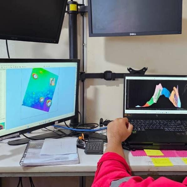
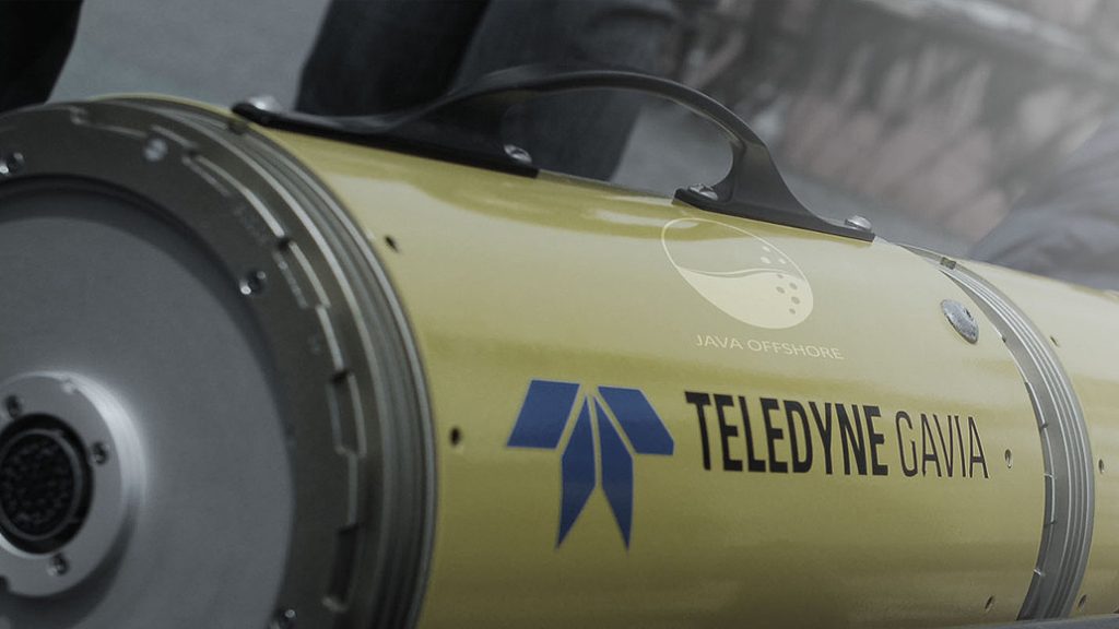
Autonomous Underwater Vehicle
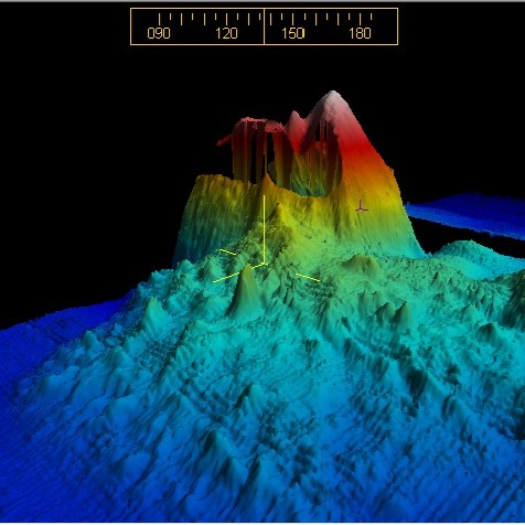
Java Offshore provides the Autonomous Underwater Vehicle (AUV) system for deep water seabed surveys or as an alternative solution to survey in exclusion zones around existing structures, for pipeline or platform inspection, construction support, scour monitoring and in nearshore areas beyond 1m water depth.
The Gavia Surveyor AUV can be easily deployed and operates between 1 to 1000m water depths. It has the ability to acquire high quality data via a set of modular sensors including an Intertial Navigation System, Geoswath Multi-beam, Side Scan Sonar and an underwater camera.
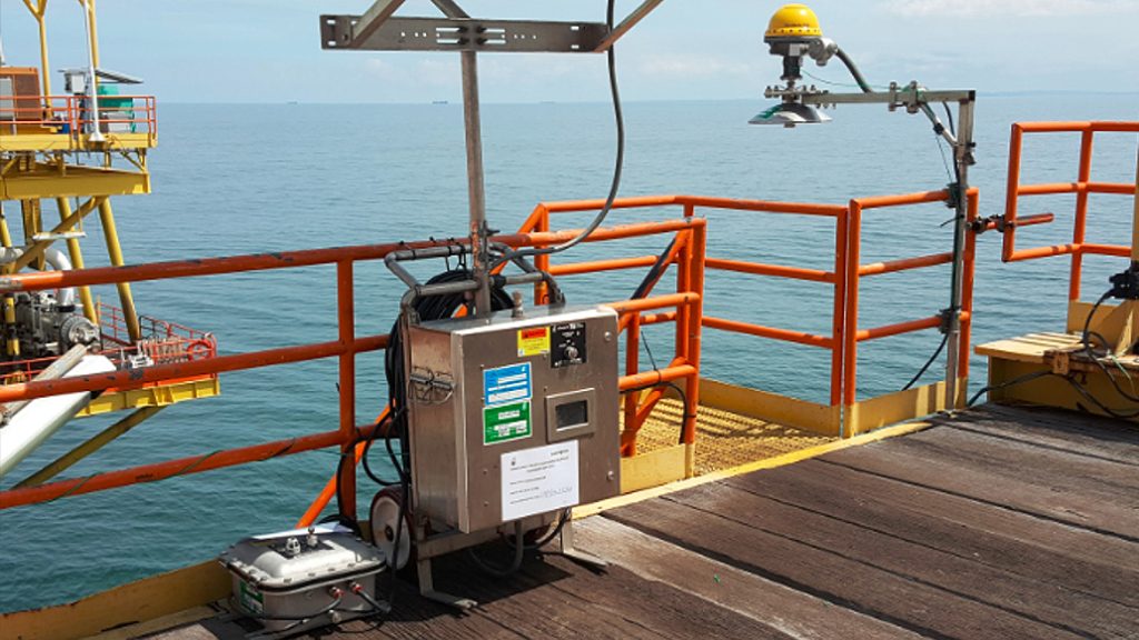
Structural Dynamic Monitoring
Java Offshore provides Structural Dynamic Monitoring (SDM) systems for asset integrity solutions that ensure the safety of your personnel and offshore structures. SDM technology monitors the stiffness and robustness of a structure through measuring its motions. Our accurate monitoring reveals information on orientation, position, physical and environmental conditions to support your marine subsea operations.
Offshore SDM data reveals the actual response and health of the platform structures through a combination of structural mechanics and behaviour platform structures with advanced data cleansing, signal processing and statistical analyses. Any changes in natural frequency will require further investigation on the stiffness of the structure and may indicate certain damage to the platform.
Our Other Equipments
Autonomous Underwater Vehicle
Java Offshore provides the Autonomous Underwater Vehicle (AUV) system for deep water seabed surveys or as an alternative solution to survey in exclusion zones around existing structures, for pipeline or platform inspection, construction support, scour monitoring and in nearshore areas beyond 1m water depth.
The Gavia Surveyor AUV can be easily deployed and operates between 1 to 1000m water depths. It has the ability to acquire high quality data via a set of modular sensors including an Intertial Navigation System, Geoswath Multi-beam, Side Scan Sonar and an underwater camera.
Structural Dynamic Monitoring
Java Offshore provides Structural Dynamic Monitoring (SDM) systems for asset integrity solutions that ensure the safety of your personnel and offshore structures. SDM technology monitors the stiffness and robustness of a structure through measuring its motions. Our accurate monitoring reveals information on orientation, position, physical and environmental conditions to support your marine subsea operations.
Offshore SDM data reveals the actual response and health of the platform structures through a combination of structural mechanics and behaviour platform structures with advanced data cleansing, signal processing and statistical analyses. Any changes in natural frequency will require further investigation on the stiffness of the structure and may indicate certain damage to the platform.